Uncovering Ancient Paris: The Roman Streets That Shaped the City
The Forgotten Roman Streets of Paris: A Journey Through Time

When I walk through the streets of Paris, I can’t help but wonder what they were like during Roman times.
Beneath our feet lie the remnants of Lutetia, hidden under centuries of construction.
In this article, I’ll take you on a journey back in time to explore the origins of these streets and how the ancient layout shaped the Paris we know today.
We’ll delve into the surviving traces of the Gallo-Roman era, from the cardo maximus to the ancient baths and the long-lost quays of the Seine.
I’m excited to share this exploration of ancient Paris, where every stone has a story to tell.
Ancient Paris (before 476 AD)
Let's dive into the history of Paris's streets during the Gallo-Roman era.
Around 360 AD, Emperor Julian described Lutetia as:
"A small island lying in the river, a wall entirely surrounds it, and wooden bridges lead to it on both sides."

The site of Paris was first occupied by the Celtic tribe known as the Parisii in the third century BC.
They likely built the oppidum of Lutetia on the Île de la Cité.
Back then, the island was 6 metres lower than it is today.
Its banks often flooded due to the river's irregular flow.
This explains why archaeologists have struggled to find any Gallic buildings from that period.
In 52 BC, Julius Caesar invaded Gaul.
The Parisii rose up against the Romans, answering Vercingétorix's call.
But the Roman army, led by Titus Labienus, defeated them and established a Gallo-Roman garrison, naming it Lutetia.
By the second century AD, the town's population was around 10,000.
Quite modest compared to other cities in Gaul.
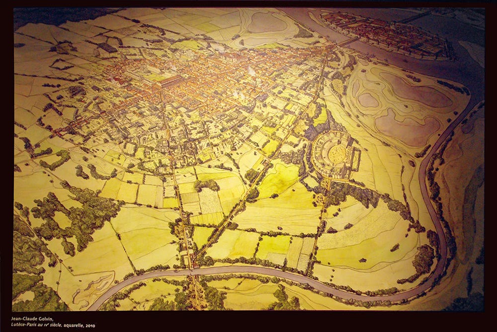
Lutetia wasn’t just the Île de la Cité.
It also stretched to a small part of the Right Bank.
However, most of the city lay on the Left Bank of the Seine.
That’s where the forum, with its basilica and temple, the public baths, and the amphitheatre were located.
The Creation of the Cardo Maximus
Our exploration of Parisian streets begins with the cardo maximus.
This was a Roman model of city planning used in Roman towns across Italy, borrowed from the Greeks.
Keep reading with a 7-day free trial
Subscribe to French Moments Newsletter to keep reading this post and get 7 days of free access to the full post archives.


